
Category:Electricity pylons in Florida
States of the United States: Alabama · Alaska · Arizona · Arkansas · California · Colorado · Connecticut · Delaware · Florida · Georgia · Idaho · Illinois · Indiana · Iowa · Kentucky · Louisiana · Maine · Maryland · Michigan · Minnesota · Mississippi · Montana · Nebraska · Nevada · New Hampshire · New Jersey · New York · North Carolina · North Dakota · Ohio · Oklahoma · Oregon · Pennsylvania · Rhode Island · South Dakota · Tennessee · Texas · Utah · Virginia · Washington · Wisconsin
Puerto Rico
Puerto Rico
Subcategories
This category has the following 2 subcategories, out of 2 total.
M
- Mickey pylon (6 F)
S
Media in category "Electricity pylons in Florida"
The following 78 files are in this category, out of 78 total.
-

-
-
 AN Railway crossing on Atwater Road.jpg 3,264 × 2,448; 2.57 MB
-
 AN Railway crossing on FL12.jpg 3,264 × 2,448; 1.94 MB
-
 AN Railway crossing under Interstate 10.jpg 3,264 × 2,448; 3.02 MB
-
.jpg/120px-Andrews_Ave_North_(40431419371).jpg) Andrews Ave North (40431419371).jpg 2,400 × 1,600; 1.88 MB
Andrews Ave North (40431419371).jpg 2,400 × 1,600; 1.88 MB
-
 Bridge From PCB to Panama City.jpg 1,024 × 768; 271 KB
-
.jpg/120px-Broward_County%2C_FL%2C_USA_-_panoramio_(2).jpg) Broward County, FL, USA - panoramio (2).jpg 1,600 × 1,200; 800 KB
Broward County, FL, USA - panoramio (2).jpg 1,600 × 1,200; 800 KB
-
 Clyde T Hopkins Park flooded boat ramp 1.jpg 3,264 × 2,448; 2.83 MB
-
 Coal Chute Pond.jpg 3,264 × 2,448; 2.43 MB
-
.jpg/120px-CR232wRoadSign-NW53Ave_(29586448261).jpg) CR232wRoadSign-NW53Ave (29586448261).jpg 2,400 × 1,600; 1.64 MB
CR232wRoadSign-NW53Ave (29586448261).jpg 2,400 × 1,600; 1.64 MB
-
 Debbie Lightsey Nature Park entrance road.jpg 3,264 × 2,448; 2.44 MB
-
 Different types power lines.jpg 4,092 × 2,340; 994 KB
-
 Dollar General at FL20 and Ravensview, Norfleet, Florida.jpg 3,264 × 2,448; 1.65 MB
-
 Dollar General, Waukeenah, Florida.jpg 3,264 × 2,072; 1.42 MB
-
 Eastern terminus of CR30A.jpg 3,264 × 2,448; 2.28 MB
-
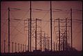
 Electricity pylons 230 kV 500 kV Pasco County Florida US 2014.jpg 2,592 × 1,944; 1.09 MB
-
 Emergency signal for Leon County Fire Station 14 on FL20.jpg 3,264 × 2,448; 1.82 MB
-
 Exxon at FL20 and Silver Lake, Norfleet, Florida.jpg 3,264 × 2,448; 2.17 MB
-
 FG&A railroad crossing at Farm Road.jpg 3,264 × 2,448; 2.63 MB
-
 FGA Lipona Drive crossing southbound.jpg 3,264 × 2,448; 1.99 MB
-
 FGA Tallahassee Subdivision crossing Brickyard Road.jpg 3,264 × 2,448; 2.61 MB
-
 FGA Tallahassee Subdivision crossing Geddie Road.jpg 3,264 × 2,448; 2.62 MB
-
 FGA Weems Road crossing.jpg 3,264 × 2,448; 2.65 MB
-
.jpg/120px-FL_82_and_CR_884_(27826346393).jpg) FL 82 and CR 884 (27826346393).jpg 1,200 × 800; 533 KB
FL 82 and CR 884 (27826346393).jpg 1,200 × 800; 533 KB
-
 FL SR 50 Power Lines-Sunshine Grove.jpg 1,800 × 1,215; 1.26 MB
-
 FL SR 50 Power Lines-Twin Dolphin-N.jpg 1,800 × 1,215; 1.22 MB
-
 FL SR 50 Power Lines-Twin Dolphin-S.jpg 1,800 × 1,215; 1.15 MB
-
 FL300 northern terminus at US98.jpg 3,264 × 2,416; 2.7 MB
-
.JPG/120px-Florida%27s_Turnpike_en_janvier_2022_(3).JPG) Florida's Turnpike en janvier 2022 (3).JPG 4,032 × 3,024; 3.51 MB
Florida's Turnpike en janvier 2022 (3).JPG 4,032 × 3,024; 3.51 MB
-
 Franklin CR30 sign.jpg 3,264 × 2,448; 2.53 MB
-
 HLCX 4216 in Tallahassee.jpg 3,264 × 2,448; 2.46 MB
-
 I-10 overpass of CR268A.jpg 3,264 × 2,448; 2.06 MB
-
 Intersection of Althea Gibson Way and Bragg Drive.jpg 3,264 × 2,364; 2.31 MB
-
 Lake Elberta.jpg 3,264 × 2,448; 1.74 MB
-
 March 2025 Lunar Eclipse behind power lines.jpg 5,568 × 3,132; 10 MB
-
 Meginnis Arm Stormwater Treatment Facility.jpg 3,264 × 2,448; 2.51 MB
-
 New Tampa, Tampa, FL, USA - panoramio.jpg 2,592 × 1,944; 1.62 MB
-
 North Point Christian Church.jpg 3,264 × 2,448; 2.17 MB
-
 Northern end of Suncoast bike trail.jpg 1,536 × 2,048; 2.08 MB
-
 Old Ochlockonee River bridge on FL377.jpg 600 × 437; 32 KB
-
 Power line at Ochlockonee River WMA.jpg 3,264 × 2,448; 2.38 MB
-
 POWER LINES BESIDE NORTH KENDALL DRIVE - NARA - 544613.jpg 3,000 × 2,023; 894 KB
-
 Power Lines on NW Side of Florida's Turnpike.jpg 4,608 × 3,456; 3.64 MB
-
 Power tower at Lake Elberta.jpg 3,264 × 2,448; 1.19 MB
-
 Power tower at Tower Road Park.jpg 3,264 × 2,448; 2.78 MB
-
 Saveway on FL20.jpg 3,264 × 2,448; 1.32 MB
-
 SB US 17; WB FL 540 to FL 655.jpg 3,648 × 2,736; 2.06 MB
-
 Shell at FL20 and CR1581.jpg 3,264 × 2,448; 2.2 MB
-
 Silver Lake Road at FL20.jpg 3,264 × 2,008; 1.71 MB
-
 SMNWR Newport Unit power lines.jpg 3,264 × 2,448; 3.01 MB
-
 Southbound on FL300 in Eastpoint.jpg 3,264 × 2,448; 1.9 MB
-
 Suspension pylon Florida US 2007.jpg 1,280 × 960; 150 KB
-
.jpg/120px-The_Villages%2C_FL%2C_USA_-_panoramio_(13).jpg) The Villages, FL, USA - panoramio (13).jpg 2,592 × 1,836; 872 KB
The Villages, FL, USA - panoramio (13).jpg 2,592 × 1,836; 872 KB
-
 Tiger Hammock Road powerlines.jpg 3,264 × 2,448; 1.82 MB
-
 Tower Road Park parking area.jpg 3,264 × 2,448; 1.9 MB
-
 Tower Road Park retention area.jpg 3,264 × 2,448; 2.53 MB
-
 Traffic light at Althea Gibson Way and Orange Avenue.jpg 3,264 × 2,448; 2.59 MB
-
 Traffic light at Althea Gibson Way and Osceola Street.jpg 3,264 × 2,448; 2.26 MB
-
 Traffic light at Althea Gibson Way and Perkins Way.jpg 3,264 × 2,448; 1.53 MB
-
 Traffic light at CR146 and Riggins.jpg 3,264 × 2,448; 2.01 MB
-
 Traffic light at CR146 and Surgeons.jpg 3,264 × 2,228; 2.42 MB
-
 Traffic light at FL20 and CR1581.jpg 3,264 × 2,448; 1.84 MB
-
 Traffic light at FL20 and CR1585.jpg 3,264 × 2,356; 1.9 MB
-
 Traffic light at FL20 and FL79.jpg 3,200 × 2,012; 1.09 MB
-
 Traffic light at NB US319 and SB FL61.jpg 3,264 × 2,448; 1.75 MB
-
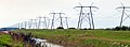 Twenty Mile Bend, Florida.jpg 2,736 × 998; 2.04 MB
-

-
 Twin Rivers State Forest, Twin Rivers Wildlife Management Area.jpg 5,184 × 3,456; 7.22 MB
-
 Twin Rivers State Forest, Twin Rivers Wildlife Management Information Area.jpg 5,184 × 3,456; 9.85 MB
-
 US 27 near I-75 south01.jpg 3,264 × 2,448; 1.82 MB
-
 US Route 27 with the Everglades.jpg 4,056 × 3,040; 3.45 MB
-
 US27 and FL59.jpg 3,264 × 2,348; 1.81 MB
-
 US98 westbound approaching CR30A.jpg 3,264 × 2,448; 2.1 MB
-
 US98 westbound at CR30A.jpg 3,264 × 2,448; 1.77 MB
-
 WB I-10 Madison Co Weigh Station; Gore Sign.jpg 4,608 × 3,456; 3.81 MB
-
 Westbound CR30A.jpg 3,264 × 2,448; 2.56 MB
-
 WFTS-TV station 1 and Raymond James Stadium.jpg 959 × 585; 185 KB


.jpg)

.jpg)


.jpg)


.jpg)


.JPG)


.jpg)


