
Category:Northumberland County, Pennsylvania
Counties of Pennsylvania : Adams · Allegheny · Armstrong · Beaver · Bedford · Berks · Blair · Bradford · Bucks · Butler · Cambria · Cameron · Carbon · Centre · Chester · Clarion · Clearfield · Clinton · Columbia · Crawford · Cumberland · Dauphin · Delaware · Elk · Erie · Fayette · Forest · Franklin · Fulton · Greene · Huntingdon · Indiana · Jefferson · Juniata · Lackawanna · Lancaster · Lawrence · Lebanon · Lehigh · Luzerne · Lycoming · McKean · Mercer · Mifflin · Monroe · Montgomery · Montour · Northampton · Northumberland · Perry · Philadelphia · Pike · Potter · Schuylkill · Snyder · Somerset · Sullivan · Susquehanna · Tioga · Union · Venango · Warren · Washington · Wayne · Westmoreland · Wyoming · York
county in Pennsylvania, United States   | |||||
| Upload media | |||||
| Instance of | |||||
|---|---|---|---|---|---|
| Named after | |||||
| Location | Pennsylvania | ||||
| Capital | |||||
| Inception |
| ||||
| Population |
| ||||
| Area |
| ||||
| Different from | |||||
| official website | |||||
 | |||||
Subcategories
This category has the following 15 subcategories, out of 15 total.
E
G
H
P
T
Media in category "Northumberland County, Pennsylvania"
The following 98 files are in this category, out of 98 total.
-
.jpg/120px-American_Legion_Post_44_(82598).jpg) American Legion Post 44 (82598).jpg 3,288 × 2,062; 2.72 MB
American Legion Post 44 (82598).jpg 3,288 × 2,062; 2.72 MB
-
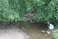
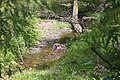
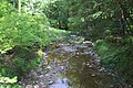
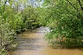
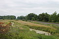 Beaver Run looking downstream.JPG 2,256 × 1,504; 2 MB
-
 Beaver Run near Turbotville.JPG 2,256 × 1,504; 2.79 MB
-
 Bennys Run looking downstream.JPG 2,056 × 3,088; 3.02 MB
-
 Bennys Run looking upstream.JPG 1,941 × 2,997; 1.96 MB
-
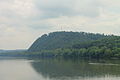 Bluff and the Susquehanna River.JPG 2,256 × 1,504; 2.28 MB
-
 Boile Run 1.JPG 3,088 × 2,056; 2.41 MB
-
 Boile Run 2.JPG 2,056 × 3,088; 2.35 MB
-
 Camel in Northumberland County, Pennsylvania.JPG 2,152 × 1,353; 1.3 MB
-
 Chestnut Oak in Weiser State Forest.JPG 2,056 × 3,088; 2.41 MB
-
 Chillisquaque Creek at the Gottlieb Brown Covered Bridge.JPG 3,088 × 2,056; 1.59 MB
-
 Chillisquaque Creek looking downstream in its lower reaches.JPG 3,088 × 2,056; 1.71 MB
-
 Chillisquaque Creek looking upstream in its lower reaches.JPG 2,056 × 3,088; 2.26 MB
-
 Coal Run in its upper reaches.JPG 2,056 × 3,088; 2.29 MB
-
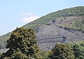
 Coal waste pile west of Trevorton, Pennsylvania detail 6.JPG 2,256 × 1,504; 2.18 MB
-
 County Line Branch 1.JPG 2,256 × 1,504; 2.84 MB
-
 County Line Branch 2.JPG 2,256 × 1,504; 2.57 MB
-
.pdf/page1-83px-Cornell_University_Library_digitization_(IA_cu31924009706841).pdf.jpg) Cornell University Library digitization (IA cu31924009706841).pdf 1,025 × 1,487, 1,424 pages; 43.96 MB
Cornell University Library digitization (IA cu31924009706841).pdf 1,025 × 1,487, 1,424 pages; 43.96 MB
-
 Culm pile near Shamokin, Pennsylvania 1.JPG 2,123 × 1,498; 2.05 MB
-
 Culm pile near Shamokin, Pennsylvania 2.JPG 2,256 × 1,504; 2.34 MB
-
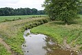
 Delaware Run.JPG 2,256 × 1,504; 2.94 MB
-
 Dry Run looking downstream.JPG 2,848 × 4,272; 5.3 MB
-
 Dry Run looking upstream.jpg 2,848 × 4,272; 4.82 MB
-
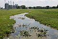
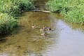 Ducks on Limestone Run.JPG 3,088 × 2,056; 1.78 MB
-
 East side of the Dornsife Gap.JPG 2,256 × 1,504; 2.19 MB
-
 Glade Run looking downstream.jpg 2,848 × 4,272; 6.17 MB
-
 Glade Run looking upstream.jpg 2,848 × 4,272; 6.17 MB
-
 Glen Burn Bank 1.JPG 3,088 × 2,056; 2.65 MB
-
 Glen Burn Bank 2.JPG 3,088 × 2,056; 2.07 MB
-
 Gravel Run 1.JPG 3,088 × 2,056; 1.8 MB
-
 Gravel Run 2.JPG 2,056 × 3,088; 2.5 MB
-
 Hallowing Run looking downstream.JPG 2,056 × 3,088; 2.9 MB
-
 Hallowing Run looking upstream.JPG 2,056 × 3,088; 2.79 MB
-

-
 Kipps Run in its upper reaches.JPG 1,904 × 3,058; 1.91 MB
-
 Kipps Run looking downstream in its lower reaches.JPG 2,056 × 3,088; 1.77 MB
-
 Kipps Run looking upstream.JPG 2,056 × 3,088; 2.23 MB
-
 Lick Creek looking downstream.JPG 1,698 × 2,851; 2.57 MB
-
 Lick Creek looking upstream.JPG 2,056 × 3,088; 3.49 MB
-
 Lithia Springs Creek looking downstream.JPG 2,056 × 3,088; 1.9 MB
-
 Lithia Springs Creek looking upstream.JPG 2,056 × 3,088; 2.13 MB
-
 Little Roaring Creek.JPG 2,256 × 1,504; 3.57 MB
-
 Little Shamokin Creek satellite map.PNG 398 × 350; 330 KB
-
 Little Shamokin Creek.JPG 2,056 × 3,088; 2.72 MB
-
 Locust Creek looking upstream from Marshall Street.JPG 2,056 × 3,088; 2.6 MB
-
 Locust Creek looking upstream.JPG 2,056 × 3,088; 2.2 MB
-
 Logan Run.JPG 1,504 × 2,256; 2.39 MB
-
 Mahanoy Creek looking downstream near its mouth.JPG 2,056 × 3,088; 3.06 MB
-
 Mahanoy Creek looking upstream near its mouth.JPG 2,005 × 3,024; 2.2 MB
-
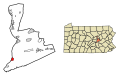
 Map of Pennsylvania highlighting Northumberland County.svg 1,980 × 1,138; 96 KB
-
 Millers Run.JPG 2,056 × 3,088; 3.09 MB
-
 Mouse Creek looking upstream.JPG 2,056 × 3,088; 2.95 MB
-
 Mouth of Millers Run.JPG 2,020 × 3,033; 2.65 MB
-
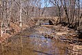
 North Branch Shamokin Creek.JPG 3,088 × 2,056; 2.87 MB
-
-
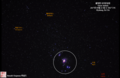 Orion Nebula 2017년 09월 23 일 @ 0827 UTC Elysburg, Pa USA.png 1,533 × 1,000; 2.13 MB
-
 Pennsylvania Route 890 north.JPG 2,967 × 2,056; 2.3 MB
-
 Pennsylvania Route 890 south.JPG 3,088 × 2,056; 2.42 MB
-
 Pennsylvania Route 901 east.JPG 2,104 × 2,047; 1.08 MB
-
 Pennsylvania Route 901 west.JPG 3,088 × 2,056; 1.57 MB
-
-
 Plum Creek looking downstream.JPG 2,056 × 3,021; 2.86 MB
-
 Plum Creek looking upstream.JPG 2,056 × 3,088; 2.72 MB
-
 Quaker Run looking downstream.JPG 2,056 × 3,088; 2.59 MB
-
 Quaker Run looking upstream.JPG 2,056 × 3,088; 1.84 MB
-
 Roaring Creek Trail.JPG 3,088 × 2,056; 2.43 MB
-
 Schwaben Creek looking downstream in September 2015.JPG 2,056 × 3,088; 2.46 MB
-
 Schwaben Creek looking upstream in September 2015.JPG 2,056 × 3,088; 3.75 MB
-
 Schwaben Creek satellite map.PNG 1,135 × 245; 666 KB
-
 Schwaben Creek.JPG 2,256 × 1,504; 2.35 MB
-
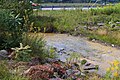
 Sealholtz Run.JPG 2,056 × 3,088; 2.41 MB
-
 Shamokin caves.jpg 960 × 960; 339 KB
-
 Shamokin Creek downstream of Shamokin.JPG 2,256 × 1,504; 2.98 MB
-

-
 Shamokin Creek looking downstream at Badmans Hill Road.JPG 2,056 × 3,088; 2.67 MB
-
 Shamokin Creek looking downstream at Millers Run.JPG 2,056 × 3,088; 2.32 MB
-
 Shamokin Creek looking downstream from QR 2034.JPG 2,056 × 3,088; 2.56 MB
-
 Shamokin Creek looking downstream in Sunbury.JPG 3,088 × 2,056; 2.48 MB
-
 Shamokin Creek looking downstream.JPG 2,256 × 1,504; 3.17 MB
-
 Shamokin Creek looking upstream at Millers Run.JPG 2,056 × 3,088; 2.63 MB
-
 Shamokin Creek looking upstream from Badmans Hill Road.JPG 3,088 × 2,056; 3.19 MB
-
 Shamokin Creek looking upstream from QR 2034.JPG 2,056 × 3,088; 2.25 MB
-
 Shamokin Creek looking upstream.JPG 2,256 × 1,504; 3.47 MB
-
 Shamokin Creek looking uptream above Quaker Run.JPG 2,056 × 3,088; 2.99 MB
-
 South Branch Roaring Creek downstream of Weiser State Forest.JPG 2,256 × 1,504; 2.97 MB
-
 Spring Run looking downstream.jpg 2,848 × 4,272; 5.44 MB
-
 Spring Run looking upstream.jpg 2,848 × 4,272; 5.81 MB
-
 Streambed of Spring Run.jpg 4,272 × 2,848; 4.14 MB
-
 Surface of Beaver Run.JPG 2,256 × 1,504; 3.13 MB
-
 Susquehanna River in late March.JPG 2,256 × 1,504; 2.6 MB
-
.jpg/120px-thumbnail.jpg)
-
_(14786911273).jpg/120px-The_story_of_some_French_refugees_and_their_%22Azilum%2C%22_1793-1800_(1903)_(14786911273).jpg) The story of some French refugees and their "Azilum," 1793-1800 (1903) (14786911273).jpg 3,076 × 2,134; 495 KB
The story of some French refugees and their "Azilum," 1793-1800 (1903) (14786911273).jpg 3,076 × 2,134; 495 KB
-
 USA Northumberland County, Pennsylvania age pyramid.svg 520 × 600; 7 KB
-
 Warrior Run.JPG 1,504 × 2,256; 3.18 MB
-
 West side of the Dornsife Gap.JPG 2,256 × 1,504; 2.41 MB
-
 Wilson Run looking downstream 1.JPG 2,038 × 3,039; 3.15 MB
-
 Wilson Run looking downstream 2.JPG 2,056 × 3,088; 3.1 MB
-
 Wilson Run looking upstream.JPG 2,056 × 3,088; 2.54 MB
.jpg)


.jpg)
_(14786911273).jpg)


