
Category:QIs by Jakec
Quality Images taken by Jakec.
Media in category "QIs by Jakec"
The following 117 files are in this category, out of 117 total.
-
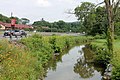
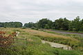 Beaver Run looking downstream.JPG 2,256 × 1,504; 2 MB
-
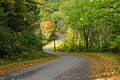
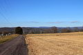
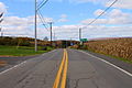
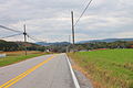 Brandonville Road.JPG 2,256 × 1,504; 2.08 MB
-
 Briar Creek Lake in August.JPG 2,256 × 1,504; 2.39 MB
-
 Bridge in Huntington Township, Luzerne County, Pennsylvania.JPG 2,247 × 1,327; 2.57 MB
-
 Buck Mountain Road.JPG 2,256 × 1,504; 2.12 MB
-
 Building in Pine Township, Columbia County, Pennsylvania.JPG 2,256 × 1,504; 3.21 MB
-
 Catawissa Creek looking downstream south of Zion Grove.JPG 2,256 × 1,504; 3.08 MB
-
 Catawissa Creek near Brandonville 2.JPG 2,256 × 1,454; 3.1 MB
-
.JPG/120px-Catawissa_Mountain_from_the_west_in_November_(2).JPG) Catawissa Mountain from the west in November (2).JPG 2,256 × 1,504; 2.3 MB
Catawissa Mountain from the west in November (2).JPG 2,256 × 1,504; 2.3 MB
-
 Central Mountain from west of Central.JPG 1,504 × 2,256; 2.24 MB
-
 Clouds above Catawissa Township.JPG 1,440 × 2,256; 1.21 MB
-
 Clouds in the sky in August 2014.JPG 2,256 × 1,504; 286 KB
-
 Coal waste pile west of Trevorton, Pennsylvania far shot 2.JPG 2,256 × 1,504; 2.63 MB
-
.JPG/120px-County_Bridge_No._23_sign_(Columbia_County%2C_Pennsylvania).JPG) County Bridge No. 23 sign (Columbia County, Pennsylvania).JPG 2,256 × 1,504; 2.89 MB
County Bridge No. 23 sign (Columbia County, Pennsylvania).JPG 2,256 × 1,504; 2.89 MB
-
 Cranberry Run Road sign.JPG 1,504 × 2,256; 2.33 MB
-
 Cumulus clouds as seen from an airplane.JPG 2,256 × 1,504; 931 KB
-
 Davis Hollow looking upstream.JPG 2,256 × 1,504; 3.1 MB
-
 Devil Hole Run looking upstream.JPG 1,504 × 2,256; 2.51 MB
-
 East Branch Briar Creek in August.JPG 2,256 × 1,477; 3.24 MB
-
 Field in Anthony Township, Montour County, Pennsylvania 2.JPG 2,256 × 1,504; 2.09 MB
-
 Field in Anthony Township, Montour County, Pennsylvania 3.JPG 2,256 × 1,504; 2.29 MB
-
 Field in Madison Township, Columbia County, Pennsylvania.JPG 1,952 × 1,504; 1.8 MB
-
 Field in Mahoning Township, Montour County, Pennsylvania.JPG 2,256 × 1,482; 2.53 MB
-
 Field in Roaring Creek Township, Columbia County, Pennsylvania 1.JPG 2,256 × 1,504; 2.57 MB
-
 Fisher Run Road 2.JPG 2,256 × 1,504; 3.26 MB
-
 Fishing Creek north of Benton.JPG 2,256 × 1,504; 3.41 MB
-
 Greenwood Township, Columbia County, Pennsylvania in January.JPG 2,256 × 1,504; 2.85 MB
-
 Greenwood Valley from Turkey Path Road 3.JPG 1,999 × 1,504; 1.8 MB
-
 Greenwood Valley scenery 1.JPG 2,256 × 1,504; 2.75 MB
-
 Hill in Catawissa Township.JPG 2,256 × 1,504; 2.18 MB
-
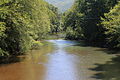
 Huntington Creek in its upper reaches 1.JPG 1,985 × 1,322; 2.47 MB
-
 Huntington Creek looking upstream from Winding Road.JPG 1,504 × 2,256; 3.4 MB
-
 Ice formation on Shingle Run Road 2.JPG 2,256 × 1,504; 2.51 MB
-
 Ice formation on Shingle Run Road 3.JPG 2,256 × 1,504; 2.3 MB
-
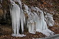
 Icicles on Shingle Run Road.JPG 1,504 × 2,256; 1.89 MB
-
 Little Fishing Creek looking downstream above Millville.JPG 2,256 × 1,504; 2.28 MB
-
.JPG/120px-Madison_Township%2C_Columbia_County%2C_Pennsylvania_in_January_(2).JPG) Madison Township, Columbia County, Pennsylvania in January (2).JPG 2,071 × 1,504; 2.31 MB
Madison Township, Columbia County, Pennsylvania in January (2).JPG 2,071 × 1,504; 2.31 MB
-
 Mahanoy Creek in Little Mahanoy Township, Northumberland County, Pennsylvania 1.JPG 2,256 × 1,504; 3.2 MB
-
 Maple Run looking upstream.JPG 1,504 × 2,256; 2.83 MB
-
 Mauses Creek looking downstream.JPG 2,256 × 1,504; 3.21 MB
-
 Montour Power Plant 2.JPG 2,256 × 1,504; 1.4 MB
-
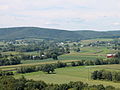
 Mountains in southwestern Columbia County, Pennsylvania 1.JPG 2,256 × 1,504; 1.85 MB
-
 Mud Run near the Kramer Covered Bridge.JPG 2,256 × 1,504; 3.48 MB
-
 Mugser Run.JPG 2,256 × 1,504; 3.68 MB
-
 Muncy Creek Township, Lycoming County, Pennsylvania.JPG 2,253 × 1,371; 1.77 MB
-
 Northeastern Huntington Township, Luzerne County, Pennsylvania from Cemetery Hill Road 3.JPG 2,256 × 1,504; 2.17 MB
-
 Northeastern Huntington Township, Luzerne County, Pennsylvania from Cemetery Hill Road 6.JPG 2,256 × 1,504; 2.24 MB
-
 Old Reading Road in the foothills of Catawissa Mountain.JPG 2,256 × 1,504; 3.56 MB
-
 Painter Run looking upstream above Oxhorn Run 1.JPG 1,504 × 2,256; 3.29 MB
-
 Painter Run looking upstream near its mouth 1.JPG 1,504 × 2,256; 3.39 MB
-
 Pennsylvania Route 118 in Lycoming County.JPG 2,256 × 1,504; 2.27 MB
-

-
 Pennsylvania Route 254 east of Washingtonville.JPG 2,256 × 1,504; 1.32 MB
-
 Pennsylvania Route 254 in Derry Township, Montour County, Pennsylvania looking west.JPG 2,256 × 1,504; 1.94 MB
-
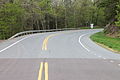
 Pennsylvania Route 254 looking west in Rohrsburg.JPG 1,504 × 2,256; 2.15 MB
-
 Pennsylvania Route 254 north of Rohrsburg.JPG 1,504 × 2,256; 2.44 MB
-
 Pennsylvania Route 254 west of Millville.JPG 2,226 × 1,459; 2.17 MB
-
 Pennsylvania Route 339 in Brandonville.JPG 2,256 × 1,504; 2.21 MB
-
 Pennsylvania Route 42 in Eyers Grove.JPG 2,256 × 1,504; 2.63 MB
-
 Pennsylvania Route 42 northbound northwest of Slabtown.JPG 2,256 × 1,504; 2.35 MB
-
 Pennsylvania Route 442 east.JPG 2,256 × 1,504; 2.31 MB
-
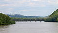
 Pennsylvania Route 54 bridge over the West Branch Susquehanna River.JPG 2,256 × 1,504; 2.51 MB
-
 Pennsylvania Route 54 crossing of the Susquehanna River.JPG 2,256 × 1,504; 1.55 MB
-
 Pennsylvania Route 54 in Anthony Township, Montour County, Pennsylvania.JPG 2,256 × 1,504; 1.94 MB
-
 Pennsylvania Route 54 near Turbotville.JPG 1,504 × 2,256; 2.4 MB
-
 Pennsylvania Route 924 in Sheppton.JPG 2,256 × 1,504; 1.82 MB
-
 Pine Creek in New Columbus, Pennsylvania.JPG 1,990 × 1,504; 2.78 MB
-
 Pothole on Huntington Creek Road.JPG 2,256 × 1,504; 3.6 MB
-
 Power lines on Catawissa Mountain 1.JPG 2,256 × 1,504; 2.58 MB
-
 Pylons in Briar Creek Township, Columbia County, Pennsylvania.JPG 2,256 × 1,504; 2.82 MB
-
 Railroad bridge over the Susquehanna River north of Catawissa.JPG 2,256 × 1,297; 1.49 MB
-
 Railroad in Montgomery, Pennsylvania.JPG 1,270 × 1,736; 1.41 MB
-
 Railroad in Northumberland County, Pennsylvania.JPG 1,504 × 2,256; 2.18 MB
-
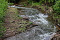
 Rapids on West Branch Fishing Creek 1.JPG 2,256 × 1,504; 2.59 MB
-
 Rapids on West Branch Fishing Creek 5.JPG 2,256 × 1,504; 2.2 MB
-
 Reykjavík Harbor vista 4.JPG 2,256 × 1,504; 1.53 MB
-
 Rock formation in Fairmount Township, Luzerne County, Pennsylvania 2.JPG 2,256 × 1,504; 3.76 MB
-
 Scenery of Benton Township, Columbia County, Pennsylvania 1.JPG 2,256 × 1,192; 2.28 MB
-
 Scenery of Mahoning Township, Montour County, Pennsylvania.JPG 2,047 × 1,504; 1.75 MB
-
 Scenery of southern Pine Township, Columbia County, Pennsylvania.JPG 2,256 × 1,504; 1.95 MB
-
 Scenery of Sugarloaf Township, Columbia County, Pennsylvania 1.JPG 2,256 × 1,504; 2.51 MB
-
 Sechler Run looking upstream.jpg 2,256 × 1,504; 2.35 MB
-
 Shamokin Creek looking downstream in Shamokin, Pennsylvania.JPG 2,034 × 1,501; 2.52 MB
-
 Shingle Run in its lower reaches.JPG 2,256 × 1,504; 2.83 MB
-
 Spruce Run looking downstream in wintertime.JPG 2,256 × 1,504; 2.58 MB
-
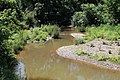
 Stream bed of Fishing Creek.JPG 2,256 × 1,504; 3.63 MB
-
 Streambed of Kitchen Creek.JPG 2,256 × 1,504; 2.82 MB
-
 Streambed of Phillips Creek.JPG 2,256 × 1,504; 2.56 MB
-
 Surface of Muncy Creek.JPG 2,256 × 1,504; 2.61 MB
-
 Tenmile Run in its lower reaches 2.JPG 2,256 × 1,504; 2.78 MB
-
 U.S. Route 11 in Danville.JPG 2,256 × 1,504; 2 MB
-
 Valley of Long Hollow.JPG 2,256 × 1,504; 1.35 MB
-
 View from Hallgrímskirkja 11.JPG 2,256 × 1,504; 1.77 MB
-
 View from Hallgrímskirkja 12.JPG 2,070 × 1,219; 1.4 MB
-
 View from Hallgrímskirkja 13.JPG 2,256 × 1,159; 1.62 MB
-
 View from Hallgrímskirkja 4.JPG 2,256 × 1,504; 2.75 MB
-
 View of Catawissa Mountain from the east.JPG 2,256 × 1,504; 1.89 MB
-
 View of Catawissa, Pennsylvania from the southeast 2.JPG 2,256 × 1,504; 2.32 MB
-
 View of East Cameron Township, Northumberland County, Pennsylvania.JPG 2,256 × 1,504; 2.12 MB
-
 View of Little Mahanoy Township, Northumberland County, Pennsylvania 2.JPG 2,256 × 1,504; 1.77 MB
-
 View of New Columbus, Pennsylvania from Fishing Creek Township 1.JPG 2,256 × 1,504; 2.62 MB
-
 View of New Columbus, Pennsylvania from Fishing Creek Township 2.JPG 2,256 × 1,504; 2.52 MB
-
 View of New Columbus, Pennsylvania from Fishing Creek Township 3.JPG 2,256 × 1,504; 3.26 MB
-
 View of Nuremberg, Pennsylvania from the south.JPG 2,256 × 1,504; 2.29 MB
-
 View of Orange Township, Columbia County, Pennsylvania looking east.JPG 2,256 × 1,504; 2.39 MB
-
 View of Scott Township, Columbia County, Pennsylvania.JPG 2,223 × 1,467; 2.03 MB
-
 View of southeastern Fishing Creek Township, Columbia County, Pennsylvania.JPG 2,107 × 1,377; 1.99 MB
-
 View of West Cameron Township, Northumberland County, Pennsylvania looking north.JPG 2,256 × 1,504; 2.28 MB
-
 West Branch Fishing Creek looking downstream in December.JPG 2,256 × 1,504; 3.2 MB
-
 West Branch Fishing Creek sign.JPG 2,256 × 1,504; 3.27 MB
-
 West Branch Run in wintertime 1.JPG 1,504 × 2,256; 2.24 MB
-
 West Branch Susquehanna River looking upstream near Montgomery, Pennsylvania.JPG 2,256 × 1,504; 1.83 MB
-
.JPG/120px-West_Creek_(Pennsylvania).JPG) West Creek (Pennsylvania).JPG 2,256 × 1,504; 3.28 MB
West Creek (Pennsylvania).JPG 2,256 × 1,504; 3.28 MB
-
 Western edge of Central Mountain.JPG 2,256 × 1,504; 1.95 MB
-
 Wetland near the headwaters of Stony Brook 1.JPG 2,256 × 1,504; 3.78 MB
-
 Zerbe Run in Trevorton looking downstream.JPG 2,256 × 1,504; 3.63 MB
-
 Zerbe Run in Trevorton looking upstream.JPG 2,256 × 1,504; 3.75 MB


.JPG)


.JPG)


.JPG)


.JPG)


